Upper Dolpo Trek
Upper Dolpo Trek: Explore Nepal’s Remote Region | Adventure Trek!!
The Upper Dolpo trek is challenging and involves high-altitude trekking, making it suitable for experienced trekkers with good physical fitness.
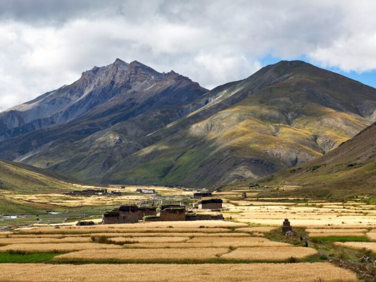
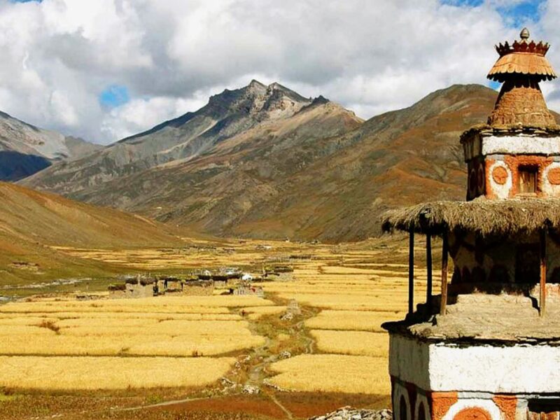
Upper Dolpo is a remote and culturally rich region located in the northwestern part of Nepal. It is known for its pristine landscapes, ancient monasteries, and unique Tibetan-influenced culture. Upper Dolpo is part of the Trans-Himalayan region, characterized by arid terrain.
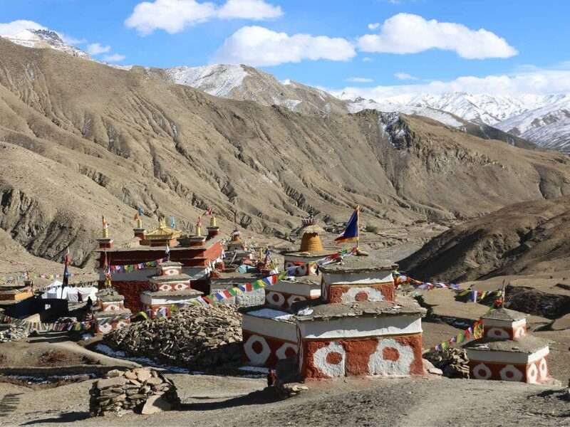
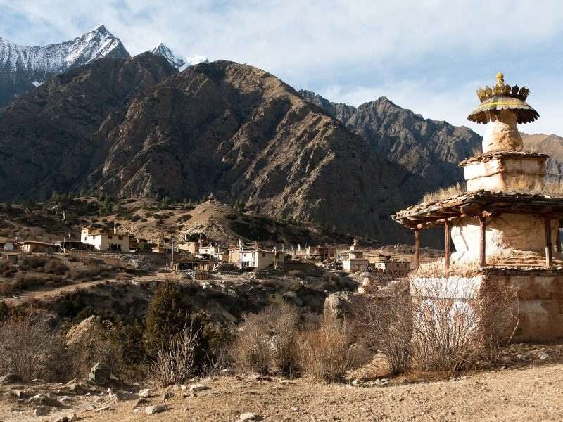
The features of this region are diverse landscapes, including high plateaus, deep canyons, and barren hills. It is full of ancient monasteries, including Shey Gompa and Crystal Mountain Monastery. These monasteries are not only religious centers but also cultural landmarks of Tibetan Buddhism. The majority of the population in Upper Dolpo consists of people of Tibetan origin who follow Tibetan Buddhism.
Upper Dolpo is home to Shey Phoksundo National Park, Nepal’s largest national park. The park is renowned for its pristine alpine meadows, pristine lakes, and diverse flora and fauna, including the elusive snow leopard, blue sheep, Himalayan tahr, and various species of birds.
Trip Overview
 Trip code: DR 101
  Duration: 26 Days
  Max Altitude: Kang la Pass (5360 m)
  Transportaion: Flight
  Accomodation: Hotel / Lodge or Teahouse
  Start: Kathmandu
  End: Kathmandu
  Meals: European Plan
 Outline Itinerary
Kathmandu (Arrival) – Transfer to Hotel (Private Transfer)
Kathmandu (1400m)Kathmandu – Nepalgunj (Fly – Flight Transfer)
Nepalgunj (150 m; 1 hrs)Nepalgunj – Jhupal (Fly – Flight Transfer) - Dunai
Jhupal (2400 m; 45 mins) Dunai (2850 m; 3 hrs)Dunai – Ankhe
Ankhe (2896 m; 6 hrs)Ankhe – Sulighat
Sulighat (3180 m; 5 hrs)Sulighat – Phoksundo Lake
Phoksundo Lake (3612 m; 5 hrs)Phoksundo Lake
Phoksundo Lake (3612 m)Phoksundo Lake - Phoksundo Khola Camp
Phoksundo Khola Camp (3507 m; 5 hrs)Phoksundo Khola Camp – Phoksundo Bhanjyang
Phoksundo Bhanjyang (3910 m; 6 hrs)Phoksundo Bhanjyang – Shey Gompa
Kang la Pass (5360 m) Shey Gompa (4500 m; 6 hrs)Shey Gompa
Shey Gompa (4500 m)Shey Gompa - Namduna Gaon
Saldang La Pass (5200 m) Namduna Gaon (4800 m; 6 hrs)Namduna Gaon – Saldang
Saldang (3620 m; 5 hrs)Saldang – Yangze Gompa
Yangze Gompa (4960 m; 4 hrs)Yangze Gompa – Sibu
Sibu (4560 m; 6 hrs)Sibu – Jeng La Phedi
Jeng La Phedi (4900 m; 6 hrs)Jeng La Phedi – Tokyu Gaon via Jeng La Pass
Jeng La Pass (5090 m) Tokyu Gaon (4209 m; 7 hrs)Tokyu Gaon – Dho Tarap
Dho Tarap (4040 m; 5 hrs)Dho Tara
Dho Tara (4040 m)Dho Tarap – Tarap Khola
Tarap Khola (3800 m; 6 hrs)Tarap Khola – Khani Gaon
Khani Gaon (3150 m; 5 hrs)Khani Gaon – Tarakot
Tarakot (2537 m; 5 hrs)Tarakot – Dunai
Dunai (2850 m; 6 hrs)Dunai – Jhupal
Jhupal (2320 m; 3 hrs)Jhupal – Nepalgunj – Kathmandu (Fly – Flight Transfer)
Kathmandu (1400 m; 2 hrs)Kathmandu (Departure)
Price Inclusion
- Airport transfers (Domestic/ International) on a tourist vehicle
- Domestic flight ticket (Kathmandu / Nepalgunj / Kathmandu) (Nepalgunj / Jhupal / Nepalgunj)
- Entire accommodation during the trek – 2 nights at hotel in Kathmandu, and 22 nights in lodges/guesthouse during trek to Upper Dolpo
- Hotel Breakfast during the stay at Kathmandu
- Experienced, government licensed, English-speaking or another language trekking guide
- All necessary permits for Shey Phoksundo National Park and Upper Dolpo restricted area
- Porters during the trek for carrying luggage (1 porter for every 2 pax)
- All government taxes and administrative expenses
- Local staff insurances
Price Exclusion
- International flight tickets and Nepal Entry Visa
- Personal travel insurance+
- Any meals during the trek
- Any expenses of a personnel nature, e.g., telephone calls, laundry, table drinks, etc.
- Any Tips to Guides, Drivers, and Trekking Staffs
- Any entrance fees for cameras and video cameras at the monuments
- Any other services not mentioned above
- Cost of any emergency evacuation, strikes, etc.
Detail Itinerary
Expand AllKathmandu (Arrival) – Transfer to Hotel (Private Transfer)
Upon arrival in Kathmandu, the capital city of Nepal, our representative will be waiting at the airport for your welcome. Then board a private vehicle and be transferred to your hotel. Check into your hotel and rest after your journey.
Depending on your arrival time, you may have the opportunity to explore ancient temples and vibrant markets and experience the unique atmosphere of Nepalese urban life.
Kathmandu – Nepalgunj (Fly – Flight Transfer)
After having breakfast, you will board a flight from Kathmandu to Nepalgunj, which takes approx.1 hour. Upon arrival in Nepalgunj, you will transfer to your hotel. Nepalgunj is a town near Nepal-India border. You can relax on your hotel or visit the local market and prepare for the upcoming adventure.
Nepalgunj – Jhupal (Fly – Flight Transfer) - Dunai
On this day, you will take another flight from Nepalgunj to Jhupal, which takes around 45 minutes. Upon arrival in Jhupal, you’ll begin trekking to Dunai. You will trek through terraced fields to the Bheri River and narrow gorge to reach Dunai, the district headquarters of Dolpa, which marks the starting point of your trek.
Dunai – Ankhe
After leaving Dunai, you walk over a suspension bridge and follow a trail past a hospital before heading west. Before reaching the Phoksundo River Valley, the trail climbs the side of the treeless Thulo Bheri Valley. You reach a view of Kagmara Peak looking up the valley during our walk. After passing through settlements called Dhera and Rahagaun, walnut trees, and deep jungles, you finally arrive in Ankhe.
Ankhe – Sulighat
The path climbs on a steep trail and winds along a riverside covered in trees. There are various streams along the way that offer a chance to cool off, but the ups and downs might get a little repetitive. After a while, the trail emerges from the woods and goes along a grassy ascent that climbs above the river.
You hike down a trail through lush forests until we come down a rough stone climb to the riverbank. You keep walking until we arrive at Sulighat.
Sulighat – Phoksundo Lake
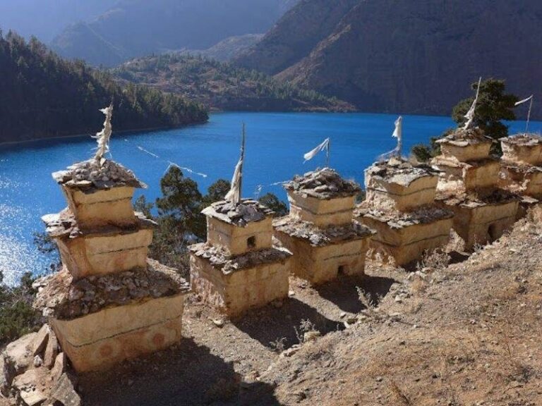
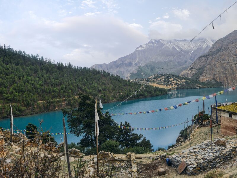
You continue to move down the valley level until you reach the crossing point of the Phoksundo and Pungmo rivers. You hike down the Pungmo Khola’s western bank after stepping over a bridge. The path leads through a forest of cedar trees before arriving at the Palam settlement. From here, you trek up to a ridge where you can see Phoksundo Lake in the distance as well as a magnificent waterfall.
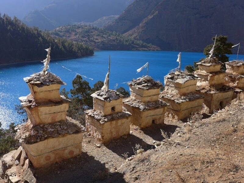
The path that follows next climbs through forests of birch to the upper levels of the Phoksundo Khola and finally arrives at the charming village of Ringmo, with its mani walls and chortens painted with mud. The Phoksundo Lake shores are only a short walk away from here.
Phoksundo Lake
You will be enjoying and acclimating to Phoksundo Lake. You can take a short hike to reach the Tibetan Buddhist monastery in the village of Ringmo. Your walks also give you an opportunity to learn about the customs and culture of the area.
The Dolpo people use Tibetan-style somba or dhocha (boots with upturned toes) for footwear, and they dress in homespun garments that are occasionally painted a maroon color. Religious amulets and strings of coral, amber, and turquoise are frequently worn by men as well as women.
Phoksundo Lake - Phoksundo Khola Camp
Your trail follows a rocky ledge along the western bank of Phoksundo Lake, around the upper western end of the lake. This unsteady route, which is suspended from a wooden gangway and secured up by pegs driven into a rock chasm, indicates how far we are going to be from civilization.
The path opens up into the Phoksundo Khola flood plain at the westernmost point of the lake, passing through a lush meadow. Then, as you stroll along the valley, you cross the river, avoiding the sporadic marshy areas beneath our feet, and eventually you arrive at the river’s bank.
Phoksundo Khola Camp – Phoksundo Bhanjyang
You hike for about an hour through a glacial valley, facing north. An ancient wooden bridge crosses the Phoksundo Khola at the confluence of another mountain stream. From this point on, you move northeast on foot. After a long ascent, your trail goes up a rocky valley into a sheep meadow. After a hard climb to the summit, you reach another valley from which the Kang-La pass is visible.
You also get to see panoramas of Chhamlang Peak VI and Peak VII on the walk towards Phoksundo Bhanjyang.
Phoksundo Bhanjyang – Shey Gompa
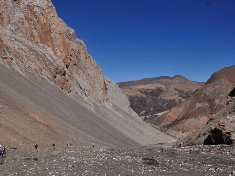
In the morning, you ascend on a steep trail littered with slate towards the pass. It’s a challenging trek to the top of the pass. You will get great views of the large valley divided by a river from the top of Kang-la Pass (5360 m). You take a difficult trail down to the valley floor.
After that, you go along a narrow path beside a river, frequently crossing it. The hillsides that face the river are lined with mud caves. Also, you travel through meadows where hundreds of sheep, yaks, and domestic mountain goats (Chyangra) can be seen grazing. A charming log bridge leads you to the Shey Gompa.
Shey Gompa
Shey Gompa is a monastery that was built in 1655 and is well-known for its huge copper statue of a sitting Shakyamuni Buddha covered in gold. One of the oddest mountains, Crystal Mountain, lies to the east of the gompa. Its contorted cliffs are covered in quartz and covered with a wide diversity of sea fossils.
Another day of acclimatization is today. You hike about Shey village, which is well-known for the Bon Po, an ancient pre-Buddhist culture. The ancient Tibetan style of life in Dolpo blends Buddhism and animism.
Shey Gompa - Namduna Gaon
You start the day by walking along an enjoyable trail among the juniper trees that leads down into a stony, gray canyon. After there, the trail zigzags across rough, eroded soil and exposed rocks until it finally reaches the summit of Saldang-la Pass (5200m).
After that, there is a long and difficult descent towards the north, although it is pleasant to see yaks and sheep grazing and to see nomadic tents made of yak hair. You visit Namgung monastery in Namduna Gaun (4800m). The monastery, made of red stone, is situated on the north wall of a gorge, with a cliff as its backdrop.
Namduna Gaon – Saldang
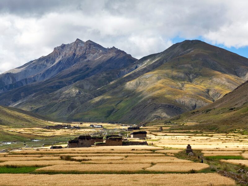
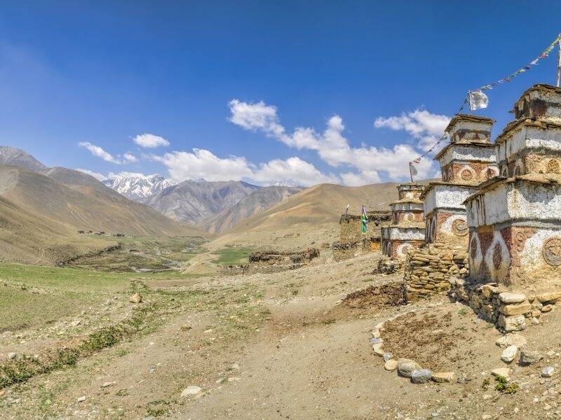
You leave the village and trek along the dusty, barren mountains for a while after climbing up a rise. You reach Saldang Village, which is situated on a plateau above the Namga Khola stream, after a strenuous 3- to 4-hour trek. It appears to be picturesque. The biggest settlement in the inner Dolpo region is called Saldang.
The town is composed of five settlements with roughly eighty well-built dwellings and over six hundred residents. It extends across two kilometers on an open slope. The village enjoys prosperity not just from agriculture but also from its advantageous location on a trade route leading to Tibet.
Saldang – Yangze Gompa
You keep trekking north along the Nagon Khola (river) from Saldang through unmanaged and barren terrain. You start off on a path that is very steady and has some ups and downs. You pass through the villages of Marang and Ki on the way. You next cross a Panzang River tributary, continue toward the east, and cross the river once more to arrive at Yangze Gompa, the site of an ancient Bon-Po Monastery.
Yangze Gompa – Sibu
There are two pathways that lead to Sibu from Yangze. You will take the quicker and easier route, which is to return the path back towards Saldang village, to save time. You proceed from Saldang along a river, passing terraced fields, chortens, stupas, piles of mani stones, and a Chaiba monastery.
You are following a stroll through another rich community called Namdo, which has about 400 residents living in about sixty houses. It goes about 5 kilometers on the steep hillsides to Nam Khong Khola’s left. The riverbed is close to the Namdo monastery. You trek for an additional two hours down the river to camp close to the tiny town of Sibu.
Sibu – Jeng La Phedi
After a while, you stroll along the Nam Khong Khola, passing yak caravans heading for the Tibetan border. You continue for a while before turning east and coming to the intersection of two tiny creeks. After there, the rocky trail climbs to a grazing region at 4900 m below the Jeng La pass. You’ll set up camp here in this lovely meadow.
Jeng La Phedi – Tokyu Gaon via Jeng La Pass
You get up early and start our journey for the day. You must hike for two hours to get to the top of Jeng La Pass (5,090m), which offers breathtaking views of the Dhaualgiri massif’s north face. From here, you follow a rocky trail down to the Tarap region, which is a wonderful region that covers 20 km along the Tarap Chu river and features large grasslands surrounded by steep mountains to reach Tokyo.
Tokyu Gaon – Dho Tarap
You walk downward through a plain valley that is quite distinct from other areas of inner Dolpo, with patches of green grass on both sides of the river. Also, there is a marsh, which is a characteristic of the Ladakh Himalaya and the Tibetan Desert Mountains.
In the valley, people practice both the Buddhist and Bon Po sects. You trek a short distance to get to Dho Tarap.
Dho Tara
Today, you rest and walk through the rough stone wall that surrounds the settlement of Dho Tarap. You will learn more about the local way of life through our hikes. A small number of Tibetans and primarily Magars, a Nepalese hill tribe, live in the around 40 housing units at Dho, which are arranged into three clusters and constructed haphazardly.
Here, you’ll have the option of visiting the Buddhist gompa, which is the nearest 40-minute walk to see the Bon Po Gompa.
Dho Tarap – Tarap Khola
You descend from Tarap into a broad valley that finally narrows into a gorge. A little above the tree line, you stroll among wild rose and juniper plants. Herds of blue sheep accompany you on your hike, and by afternoon you arrive at the crossing point of the Tarap Chu and the Lang Khola, a stream that flows into the Tarap River from the east.
Tarap Khola – Khani Gaon
You keep moving down the Tarap River’s gorge, occasionally strolling next to it. You pass the locals, who will be moving their herds to lower pastures for the winter, during our stroll. This will be one of the trip’s most thrilling days since the valley narrows to such a narrow gorge in several spots that you can actually jump from one side to the other.
Occasionally, there would be no sign of a trail, forcing you to cross the gaps between the walls using stone slabs fixed atop logs as a bridge. Unexpected thrills and adventures can also be found in the gorge. In certain locations, the bridges are either destroyed or washed away, so you could have to traverse the icy torrent on foot.
Khani Gaon – Tarakot
You take a trail from the camp that leads to Lalberi village. After that, your trail goes through a verdant forest, drops into another gorge, and then returns to follow the river. Once you arrive at Tarakot, you can go to Sandul Gompa, which is located at the intersection of Barbung Khola and Tarap Chu, about 8 km east of the settlement.
South of the Bheri River, atop a hill, is the monastery. You are camping today next to the police post, by the Tarap Chu river, around 150 meters below Tarakot.
Tarakot – Dunai
You start your trek along a track behind the Bheri River and then go across a bridge close to the settlement of Lawan. Your path will carry on beside the large Bheri River, climbing all the way to the Byas Gadi. From here, the trail follows a slightly simple path westward. Near Lochakhola Gaon, you cross the river once again before climbing to Dunai.
Dunai – Jhupal
You hike beside the Bheri River from Dunai, taking in the breathtaking scenery. Along the route, you pass a temple and the villages of Dhupichaur and Rupgad. You hike on through the villages of Motipur and Kalagaonda till you arrive at the little airfield.
Jhupal – Nepalgunj – Kathmandu (Fly – Flight Transfer)
Today, you will have a flight from Jhupal to Nepalgunj, which takes around 45 minutes. Upon the arrival to Nepalgunj, you will have back to flight towards Kathmandu. You will see an incredible shift in scenery on your flight. As you return to the bustling city of Kathmandu, you can explore some of the city’s cultural and historical areas.
Kathmandu (Departure)
Depending on your flight schedule, our representative will escort you towards the airport. Before your fight schedule starts, you may have some free time in Kathmandu for last-minute shopping or sightseeing.
Why you'll love this trip
- Shey Phoksundo Lake, a mesmerizing turquoise lake surrounded by snow-capped peaks and rocky cliffs
- Encounter the traditional villages of Upper Dolpo, like Saldang and Namduna.
- Explore the culture and lifestyle of the followers of Bon Buddhism.
- Visit ancient monasteries such as Shey Gompa, Yangze Gompa, and Bon Gompa.
- Experience the biodiversity of Shey Phoksundo National Park, home to a variety of flora and fauna.
- Conquer high mountain passes like Kang La Pass, Jeng La Pass and Saldang La Pass.
- Enjoy breathtaking views of the Dhaulagiri and Kanjiroba ranges.
When To Visit
The best time to explore the Upper Dolpo is during the trekking seasons of late spring (May to June) and early autumn (September to October). During these months, the weather is relatively stable, with clear skies and mild temperatures, providing optimal conditions for trekking in this remote region. Spring brings vibrant colors to the landscapes with blooming flowers, while autumn offers clear visibility of the stunning mountain vistas. The monsoon season (July to August) should be avoided due to the possibility of heavy rainfall, which can make trails slippery and increase the risk of landslides. Winter (December to February) is extremely cold, and high mountain passes may be impassable due to snow.

Cannot see your date or not satisfied with the itinerary? We may be able to add new trip dates.
Contact UsElevation Chart
Trip Gallery
FAQs for Upper Dolpo Trek
Is the Upper Dolpo Trek suitable for beginners?
The Upper Dolpo Trek is challenging and involves high-altitude trekking, so it’s recommended for experienced trekkers with good physical fitness.
Are there teahouses and accommodations along the Upper Dolpo trail?
While teahouses and accommodations are available along some parts of the route, especially in lower elevations, the facilities are limited. Trekkers should be prepared for basic accommodations and be self-sufficient, carrying essential supplies and camping equipment for certain sections of the trek.
Is acclimatization a concern on this Upper Dolpo trek?
Yes, acclimatization is crucial due to the high altitude. The itinerary is designed to allow gradual acclimatization, but trekkers should be aware of symptoms of altitude sickness.
Is a special permit required for the Upper Dolpo trek?
Yes, a special permit is required for the Upper Dolpo trek. Since Upper Dolpo is a restricted area, trekkers need to obtain the Upper Dolpo Restricted Area Permit, which is issued by the Department of Immigration in Kathmandu.
Is it possible to hire a guide and porter for the Upper Dolpo trek?
Yes, it is recommended to hire a local guide and porter for the Upper Dolpo trek. A guide familiar with the region can navigate the challenging terrain, provide cultural insights, and ensure a safer and more enjoyable trekking experience.

